When to go to Tre Cime di Lavaredo?
→ The detailed month-by-month page, with real weather records
Best time: July to September
At a glance
Why go to Tre Cime di Lavaredo?
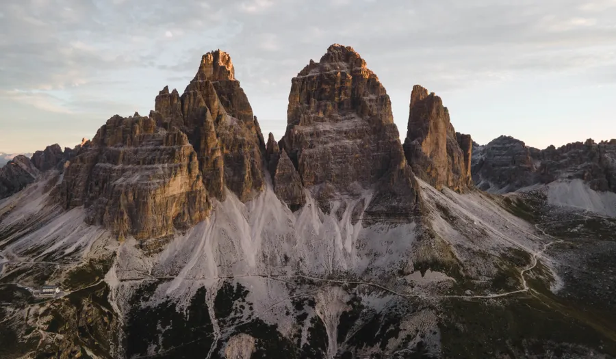
Few mountains can be recognised at a single glance. The Tre Cime can: three vertical blocks lined up like organ pipes, with Cima Grande in the middle at 2,999 m, Cima Ovest at 2,973 m and Cima Piccola at 2,857 m. Seen from the south, from Rifugio Auronzo, they look like massive, squat towers. Seen from the north, from Rifugio Locatelli, they become three sheer blades 500 metres high, which have shaped the history of mountaineering ever since Paul Grohmann's first ascent in 1869.
What sets the place apart is how unusually accessible it is for high mountain terrain. A 7 km toll road climbs from Lake Misurina to Rifugio Auronzo at 2,320 m. You therefore start the loop already up high, with just 400 metres of total ascent to tackle over 10 km. Families with eight-year-olds complete the circuit, which is rare at this altitude and explains the crowds.
The flip side is that timing is everything. The car park fills up before 9 am in July and August, the Auronzo-Lavaredo stretch then looks like a queue, and coaches keep unloading until mid-afternoon. Set off at 6 am or after 4 pm and the same path becomes a high-altitude hike again, with the north faces turning red and marmots whistling in the scree.
Map of Tre Cime di Lavaredo: what is where?
The map shows the 6 places covered in this guide, to picture the distances and plan your route.
- Rifugio Auronzo
- Rifugio Lavaredo
- Rifugio Locatelli
- Malga Langalm
- Cadini di Misurina
- Lake Misurina
How much does a trip to Tre Cime di Lavaredo cost?
The cost that surprises is access: a €40 toll for a car before you have even taken a step. Once up there, the hike itself is free and spending comes down to the huts.
| Style | Per day | What it covers |
|---|---|---|
| Backpacker | €55-85/day | Bus from Misurina, picnic bought in the valley, campsite or garni in Dobbiaco |
| Comfort | €120-170/day | Toll and hire car, two meals in huts, hotel at Lake Misurina |
| Premium | €230+/day | Half-board night at Rifugio Locatelli, mountain guide for the Paterno via ferratas, 4-star hotel in Cortina |
The huts take cards but the signal is patchy at 2,400 m: keep €40 to €50 in cash for drinks and the paying toilets.
Is Tre Cime di Lavaredo safe?
The real risk here is not the altitude but the weather. Storms often break between 2 pm and 5 pm in summer, and the Tre Cime plateau is completely exposed: check the forecast that same morning and be back before mid-afternoon. Pack a warm layer and a windproof even when it is 28°C in the valley, as it can be 8°C and very windy at the Forcella Lavaredo. Hiking boots with lugged soles are essential on the scree sections, where falls are the main reason for mountain rescue call-outs. Early and late in the season, patches of hard snow linger on the northern stretch between Locatelli and Col di Mezzo.
What to see and do in Tre Cime di Lavaredo
- Tre Cime circuit loop
- Rifugio Auronzo and the toll road
- Rifugio Lavaredo
- Rifugio Locatelli and the north face
- Malga Langalm and the lower variant
- Cadini di Misurina viewpoint
- Lake Misurina
- Forcella Lavaredo at sunrise
The Tre Cime circuit
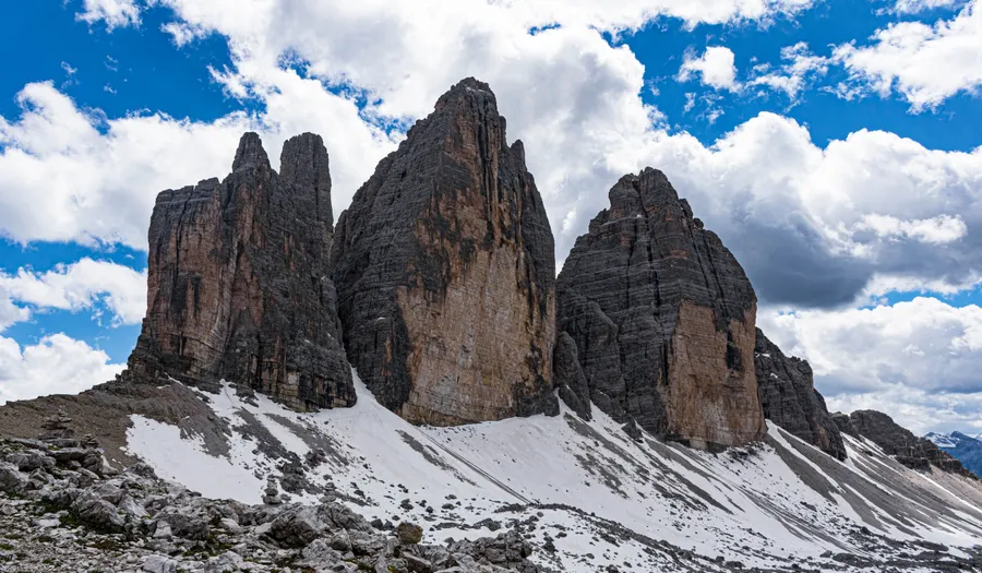
The classic loop covers 10 km with around 400 metres of total ascent and takes 4 hours including breaks. Walk it anticlockwise, from Rifugio Auronzo towards Rifugio Lavaredo, then the Forcella Lavaredo at 2,454 m and Rifugio Locatelli. This direction gives you the south faces first and the famous north view around mid-morning, before the clouds have snagged on the summits. The return runs either along the high balcony path beneath Cima Ovest or via Malga Langalm lower down. The path is wide and well marked, but take care on the stony section between Locatelli and the Forcella di Col di Mezzo, often icy early in the morning in September.
The Rifugio Auronzo toll road
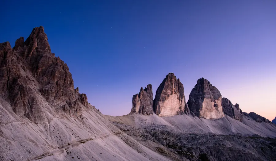
Seven kilometres of tarmac hairpins link Lake Misurina to Rifugio Auronzo at 2,320 m. In 2026 the toll costs €40 for a car, €26 for a motorbike and €60 for a campervan, and online booking is now compulsory on auronzo.info: you pick a time slot, give your number plate, email and phone number, and the ticket is valid for 12 hours. The road opens between late May and early June depending on the snowmelt, closes in late October or early November, and runs 24 hours a day in high summer. In autumn the hours narrow to around 8 am-6 pm because of ice. If the price puts you off, DolomitiBus line 31 climbs up from Misurina in 20 minutes.
Rifugio Lavaredo and the Forcella
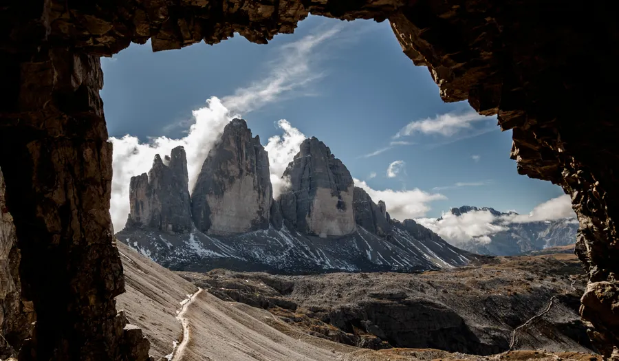
The first stop on the loop, a 45-minute, almost flat walk from the car park. Rifugio Lavaredo, at 2,344 m, serves a decent strudel and canederli on its terrace, facing Monte Paterno. A hundred metres higher, the Forcella Lavaredo at 2,454 m opens abruptly onto the north side and the Sexten Dolomites: this is the real turning point of the hike, where the light changes. Many walkers stop here and turn back, which noticeably thins out the rest of the route. Remains of First World War trenches can be seen just below the pass.
Rifugio Locatelli and the north face
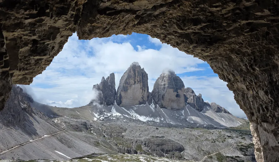
The finest viewpoint in the area, at 2,405 m, two and a half hours from the start. From its terrace you face the three north walls lined up head-on, a kilometre and a half away, in an almost unreal setting. The hut, open from mid-June to late September, has around 200 beds and is booked up months ahead: sleeping here is the only way to see sunrise and sunset on these walls, which take on a coppery hue in June and July. Just behind it, the Torri di Toblin path and the wartime tunnels of Monte Paterno make a one-hour round trip, head torch recommended.
Malga Langalm and the lower variant
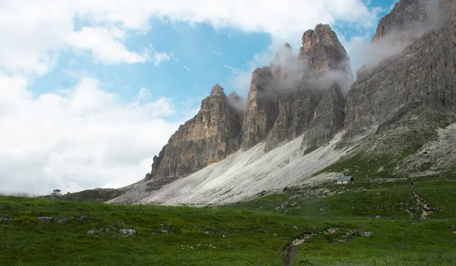
On the way back, a fork drops down to Malga Langalm at 2,283 m, a shepherds' hut turned refreshment stop where you can eat alpine cheese and barley soup. The variant adds about a kilometre to the loop and a hundred or so metres of climbing back up, but it empties the path instantly: most walkers prefer the high route. You also gain a rarely photographed angle, with the three peaks seen three-quarters on above the pastures. Allow 40 minutes more for the full circuit.
The Cadini di Misurina viewpoint
The area's other spectacle, and it faces the opposite way. From Rifugio Auronzo, the Bonacossa path number 117 heads south for 35 to 40 minutes to a promontory overlooking the finely carved spires of the Cadini. The path is narrow and exposed in places, and the viewpoint itself is reached over a few metres of easy rock: this is no place for young children or smooth soles. The late-afternoon light here is far better than the morning's. It is also an excellent fallback when the Tre Cime vanish into cloud, as the Cadini often stay clear.
How many days, and which itinerary?
One day is enough for the loop and the Cadini viewpoint; two days with a night at Rifugio Locatelli turn the outing into a genuine high-mountain experience.
🗺️ Day-by-day itinerary · 📓 Free printable Tre Cime di Lavaredo guide (PDF) · 🌍 All of the Dolomites
The efficient day (1 day)
Drive up to Rifugio Auronzo between 6 and 7 am, walk the loop anticlockwise with a break at the Locatelli, and return via Malga Langalm around 12 noon. In the afternoon, head down to Lake Misurina for a walk round the lake and an ice cream on a terrace. A full day, and you dodge the crowds entirely.
A night in a mountain hut (2 days)
Day one: an easy late-afternoon walk up to Rifugio Locatelli, sunset on the north faces, dinner and a night on the spot. Day two: up before dawn, back via the Forcella Lavaredo in total silence, then the Cadini viewpoint before heading down. The format that truly makes the trip worthwhile.
Based in Misurina or Dobbiaco (3-4 days)
One night to acclimatise in the valley, the Tre Cime loop the next day in the cool of the morning, then a day on the north side from Val Fiscalina and a last one at Lake Antorno and on the Bonacossa path. The right pace if you are travelling with children or in uncertain weather.
Getting there and getting around
A car is essential to get close: from Cortina d'Ampezzo allow 35 minutes to Misurina, from Dobbiaco 25 minutes, and from Venice airport 2h30.
Misurina-Rifugio Auronzo toll road: €40 per car in 2026, with compulsory online booking on auronzo.info including a time slot and number plate.
Without a car, DolomitiBus line 31 runs from Misurina to Rifugio Auronzo in 20 minutes, with a connection from Cortina on line 30.
The hut's car park is full by 9 am in July and August: arrive before 8 am, or book a late-afternoon slot for the evening light.
Where to stay in Tre Cime di Lavaredo?
Rifugio Locatelli, at 2,405 m facing the three north faces: around €60-75 half board in a dormitory, open from mid-June to late September, book from spring onwards.
Rifugio Auronzo and Rifugio Lavaredo, right on the loop: €55-70 half board, easier to get at the last minute than the Locatelli.
Hotels on the shores of Lake Misurina, 15 minutes from the toll road: €90-160 a night, handy for being up top at dawn.
Dobbiaco and the Puster Valley, a cheaper and better-connected base: €80-130 in a garni or family guesthouse, 25 minutes' drive to Misurina.
Our places to stay, stop by stop, at three budgets →
What to eat in Tre Cime di Lavaredo?
Canederli allo speck in broth, the Tyrolean bread dumpling served in every hut on the circuit, around €10-13.
Kaiserschmarrn, the thick, torn and sugared pancake that is the speciality of the Rifugio Lavaredo terrace, €10-14 and easily shared.
Alpine cheese and barley soup at Malga Langalm, served facing the pastures for €8-12.
Bring water: there is no spring on the loop and a small bottle costs €3 to €4 in the huts.
Entry requirements
Schengen area: an ID card or passport for EU citizens, 90 days visa-free for UK, US, Canadian and Australian passports.
Rules change: check your own government's travel advice before you go.
Frequently asked questions about Tre Cime di Lavaredo
How much does the Rifugio Auronzo road cost and do you need to book?
In 2026, €40 per car, €26 per motorbike and €60 per campervan, with compulsory online booking on auronzo.info. You choose a time slot and the ticket is valid for 12 hours.
How difficult is the Tre Cime circuit?
About 10 km with 400 metres of total ascent and 4 hours of walking on a wide path. It is an easy hike for high mountain terrain, but you need proper boots and a warm layer.
What time should you arrive to avoid the crowds?
Before 8 am, or else after 4 pm. The hut's car park is packed from 9 am in July and August, and groups fill the path until mid-afternoon.
Can you get there without a car?
Yes. DolomitiBus line 31 links Misurina to Rifugio Auronzo in 20 minutes, with line 30 from Cortina d'Ampezzo. Check the last departures, which are early at the end of the season.
When are the road and the huts open?
The toll road opens between late May and early June depending on snow cover and closes in late October. The huts on the loop operate from mid-June to late September, sometimes into early October if the weather holds.
Similar destinations
 Region
🇫🇷 The French Alps
 Country
🇸🇮 Slovenia
 City
City🇮🇹 Seceda
 City
City🇫🇷 Annecy
 Region
🇸🇮 Lake Bled
 Region
🇭🇷 Plitvice Lakes
 Region
🇫🇷 The Verdon Gorge
 Region
🇫🇷 Savoie and Mont Blanc
 Country
🇫🇷 France
 Region